
Little Elm Neighbor Sources by Block
A block question has several parts: which parcels touch the subject parcel, what legal description ties them to a subdivision, whether public planning or association material covers the area, and what source date applies. No Denton County source found in the research is a universal neighbor roster. The most defensible Little Elm neighbors method starts with parcel geography and treats each later record as a limited, dated source.
| Block source | What it can show nearby | Access route |
|---|---|---|
| DCAD parcel map | Touching parcels, site addresses, parcel IDs, subdivisions, and map layers | Public identify view, one polygon at a time |
| Denton County GIS | Boundary, precinct, road, floodplain, emergency, and district context | County map layers and data routes |
| County Clerk deed and plat records | Lot, block, subdivision, easement, conveyance, and shared-access clues | Official Records portal, counter, or mail route |
| Town archive and Planning and Zoning | Public plat, road, annexation, zoning, and notice references | Archive keyword, category, and date searches |
| Voter and precinct records | Election context and fields permitted by law | Individual status route or lawful state request |
| Historic directory and newspaper material | Year-specific street households and local events | UNT, Emily Fowler, DRC, and library research |
| HOA management certificate | Association administration and recorded declaration details | Texas certificate search, not a member list |
The parcel and deed records speak most directly to land, not current household composition. A property owner can have a separate mailing address, and an address may fall within a postal line, municipal layer, school area, or tax jurisdiction that is not the same thing. Start with the exact site address and retain the field labels shown by the record. That discipline prevents a nearby-map result from becoming a claim about a person.
Parcel Maps Around Little Elm Neighbors
The DCAD parcel service is the core geography source for an immediate Little Elm block. Parcel polygons are derived from plats, deeds, or judgments. Use the identify view to locate the subject property, capture its account or parcel identifier and legal description, then inspect only polygons that share a boundary. The service supports parcel querying and identify functions, and its documented maximum is 2,000 records. Its method is map location and parcel identification, not a radius search for people.
This DCAD parcel-map service view shows the polygon layer used to check adjacent parcels for a Little Elm neighbors question.
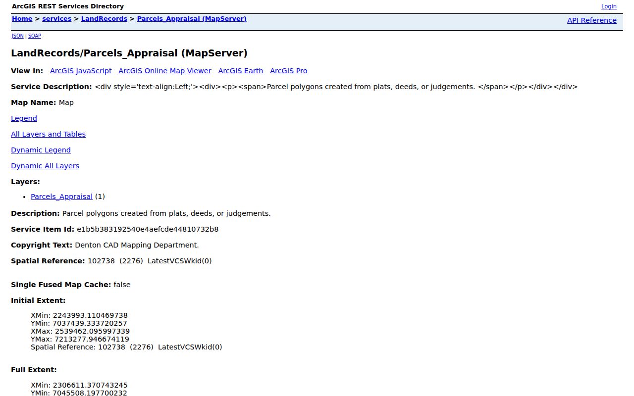
Set a readable map scale before comparing corners and boundaries. A nearby pin is not proof of an adjacent-parcel relationship. The County GIS can add roads, municipal limits, precincts, floodplain, and related context, while the town GIS can add town-service or data-hub context. Capture the layer name, scale, and observation date because a map display without a published refresh date should not be described as permanent.
| Parcel-search control | Documented use |
|---|---|
| Tax Web Search By | Choose Account Number, Owner Name, Owner Address, or Property Location. |
| Tax Web search text | Enter the address or name for the selected route; Property Location is the correct starting field for a block. |
| Inactive Accounts | Use the Yes or No setting and label an inactive result as historical rather than current. |
| DCAD identify layer | Check account or property address, owner-name, subdivision, survey abstract, map grid, Dallas block, or neighborhood context. |
Note: A parcel owner display is a land-record field and does not establish who currently occupies a nearby address.
Map a Little Elm Neighbor Block
The adjacent-parcel procedure keeps the answer tied to a defined block relationship. It also creates a short record trail that another person can check. Begin with the exact address, not an approximate point, and record only the public parcel and legal fields needed to understand the boundary. The map gives the first relationship. Tax and deed material then clarify the parcel record behind it.
- Search the subject property in the Denton County Tax Web by Property Location and retain the account number, site address, and separate owner-address field.
- Open the parcel in DCAD GIS, verify the site address and legal description, and identify each polygon that shares a boundary.
- For each touching parcel, record the public parcel identifier, site address, subdivision, lot or block, and map context without treating a mailing field as occupancy proof.
- Use the County Clerk index and plat record when the legal descriptions need to be compared or a shared easement, tract, or subdivision question remains.
- Check the town archive or county GIS for the relevant boundary, road, annexation, or planning context, then preserve unresolved differences as gaps.
For a whole named street rather than an immediate block, use the Little Elm street directory. That route follows address-keyed records farther along the street. A block method should stay focused on the subject parcel and the parcels that touch it.
Recorded Plats Behind Little Elm Blocks
Subdivision, block, lot, survey, and abstract fields are the strongest shared keys for a Little Elm block. A plat may explain why a current street address belongs to a particular lot pattern, how streets and easements were laid out, or when a tract became a subdivision. Use the County Clerk’s Official Records portal to search legal descriptions, subdivisions, document types, recorded and instrument dates, book or volume, page, and document number. The recording counter and mail or copy channels are alternatives when a portal item is unavailable.
Town archive and Planning and Zoning records can add public notices, plats, road projects, zoning, and annexation material. The 2021 annexation map lists ordinance examples from 1969 through 2021 and includes dis-annexations, but it is a planning and map reference, not a legal survey. Compare it to the current parcel and deed record instead of using an old boundary display as a final answer.
- Parcel
- A mapped unit of land associated with an account or legal description. It is not a universal label for a household.
- Plat
- A recorded map that sets out subdivision lots, blocks, streets, easements, utilities, drainage, or related land features.
- Situs address
- The property’s physical location field, distinct from an owner mailing address.
- Legal description
- The formal land description used to compare instruments when street labels differ.
Little Elm Associations and Neighbors
Little Elm Community Connections links to a town HOA Directory and Town Government Services Mapping Application. The town explains that associations can administer maintenance, pets or noise rules, exterior changes, and deed restrictions. That information helps connect a subdivision to association administration. It does not turn an association certificate or map zone into a list of the people in its homes.
The town’s Community Connections page is the source-linked entry point for the Little Elm neighbors association layer.
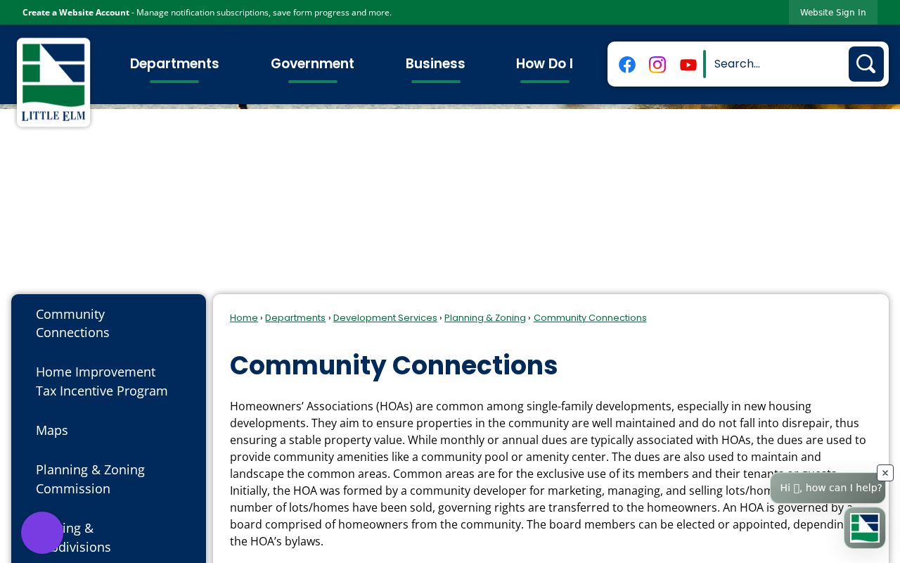
The linked HOA map uses zones and gives examples including Hillstone Pointe, Spiritas Ranch and Spiritas East, and Prairie Oaks. Its disclaimer says it is not an engineering survey and limits reproduction and use. The town also distinguishes public-improvement districts from private HOAs. A PID is created and managed through public action, while an HOA is a private association. Keep those two structures separate in block research.
Town HOA map zone
Use it to identify association geography that may relate to a subdivision. A map zone is not an engineering survey or a household roster.
Community Connections
Use the town route to locate association and mapping information. A link to an association does not confirm current membership.
Public-improvement district
Use the town’s PID material when public district information applies. A PID is not the same organization as an HOA.
Certificate Records for Little Elm Associations
The Texas HOA management-certificate search has HOA Name, County, City, ZIP, and Type filters. Denton County results include Little Elm entries such as Linden Hills Residential Community, Valencia on the Lake, Wellington Trace, Robinson Ridge, Emerald Sound, Wynfield Farms, Ladera Little Elm Condominium, and HOA Phase 3 Lakewood Estates. A search result is an administrative lead, not a household record.
The state certificate-search screen displays the filters and non-exhaustive-list context for Little Elm neighbors association research.
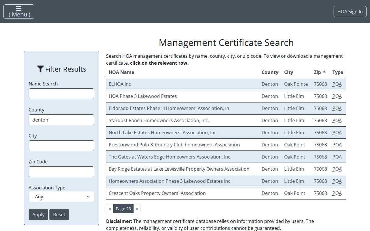
The state warns that certificate content is user-provided and that the paginated list is not exhaustive. A Ladera certificate identifies a phased Little Elm and Denton addition, declarations recorded February 7, 2024, an amendment recorded March 22, 2024, a managing agent, and a resale-document route. A Knob Hill certificate includes a Little Elm P.O. Box, manager or contact fields, recorded document references, and transfer-fee information. These details identify association administration, not every member or address.
Note: Save the certificate date and recorded-declaration reference before relying on an association detail that may later change.
Little Elm Neighbor Sources Compared
Official and commercial categories answer different questions. An official parcel, deed, plat, archive, or election source has a named custodian and a defined record scope. A commercial neighbor-search category may combine material from many places, but its timing, field logic, and completeness can be unclear. For a Little Elm block question, start with the public source that owns the underlying record and preserve the field label rather than relying on a compiled profile.
| Source category | Best use | Limit to state plainly |
|---|---|---|
| Official parcel and deed sources | Parcel boundaries, legal descriptions, recorded conveyances, and instrument details | They do not prove current household composition |
| Official town and association sources | Public planning context, association geography, and administrative certificates | They do not publish a complete member or neighbor list |
| Commercial neighbor-search category | General discovery of possible leads to verify | Accuracy, update timing, and source scope may be uncertain |
Use a primary source to check any lead. A county map, a recorded instrument, or a town record can change and may carry redactions or access limits. The Texas Public Information Act provides a written-request route for existing town or county administrative records, while judicial records follow Texas Rule of Judicial Administration 12. Neither procedure opens confidential information or creates a public neighbor roster.
Historic Neighbors in Little Elm Blocks
Historic block research requires a year-specific source. Emily Fowler Special Collections has telephone directories back to 1918, Denton city directories from the 1930s, newspapers, cemetery surveys, local histories, and microfilm. UNT’s digitized directories and the Denton Record-Chronicle indexes can supply a dated address or place clue. They are snapshots, not present-tense proof. Compare a directory or newspaper result with the parcel description, deed, census period, cemetery record, or local history before connecting it to a block.
The Little Elm community histories and county Research Room can help with older names such as Lloyd, Hackberry, Dickson, Hilltown, rural route, or Denton County. Reservoir construction relocated roads, structures, cemeteries, and residents, so an old location may not overlay the present parcel grid. Preserve the historic spelling and source citation instead of forcing an older place onto a modern street line. No complete public roster for an HOA, congregation, block-watch group, or neighborhood was located in the research.
Privacy Limits for Little Elm Neighbors
Some public records contain protected fields, and many important fields are not public at all. Texas Election Code §13.004 protects state identification numbers and specified phone and address data. The Texas Attorney General’s Address Confidentiality Program provides a substitute address for qualifying participants. A voter-status result can confirm limited election context, but it is not a current-address certificate. Utility and delivery-account details are not a public block directory.
Denton County Elections, the state voter-status route, the County Clerk, DCAD, town archive, and association certificate search each have different scope and correction or confidentiality processes. When a field seems wrong or sensitive, ask the custodian whether it is public, confidential, or subject to correction or suppression. Do not publish protected identifiers, turn a mailing address into an occupancy assertion, or collect more information than the question requires.
Lawful use. Little Elm neighbors research is for lawful personal, civic, and property questions. Do not use a parcel, association, or public-record finding to watch, harass, intimidate, or harm another person; Texas Penal Code §42.072 addresses stalking.