
Walk Little Elm Streets by Address
Start with the actual property location, not a name alone. The county tax search distinguishes a property location from an owner mailing address, and that distinction matters in Little Elm. A mailing address can belong to a trust, an entity, or an owner who receives mail elsewhere. The location result can establish the parcel used for the search, but it does not prove that a named owner currently occupies the place. Keep the exact label that appeared beside each value.
- Run the house number and street in Denton County Tax Web using the Property Location route. Save the account number, status, and separately displayed owner and mailing fields.
- Open the parcel in DCAD GIS. Confirm the site address, legal description, subdivision, lot or block, and map location before treating a tax hit as the right street address.
- Use the legal description or subdivision in Denton Official Records. Follow a grantee forward and a grantor backward, preserving both instrument and recording dates.
- Use VoteTexas registration status only to corroborate a named person through its VUID, driver-license when supplied, or first-and-last-name routes. It is not a street-by-street roster, and protected addresses may not display.
- Check the town archive, plats, and Planning and Zoning material when the road name, subdivision, or city boundary appears to have changed. These records translate map and legal-description language.
- For an older household connection, compare the year-specific telephone or city-directory entry with a newspaper, cemetery, census, deed, or tax source. The historical entry is a dated association, not proof of a current resident.
That order keeps the Little Elm street directory focused on the address trail. A property result produces the parcel key, a deed connects recorded parties to that key, and a dated directory can add a household clue. It also avoids treating an owner address, a voter record, or an agenda name as though each meant the same thing.
Little Elm Street Directory Coverage
Several custodians hold address-keyed records for Little Elm, but none is a complete household roll. The tax account and appraisal parcel are useful at the start because they tie the street to a formal account and legal description. The Clerk’s index adds conveyances and plats. Town material can explain development activity or municipal chronology. Historical resources add a dated name or place layer when the current records are too recent.
| Address record | Custodian | Street clue | Access route |
|---|---|---|---|
| Tax account | Denton County Tax Assessor-Collector | Account, owner name, mailing address, property location, active and payment status | Online search, counter, or phone |
| Appraisal parcel | Denton Central Appraisal District | Property ID, legal description, subdivision, block or lot, exemptions, and value fields | DCAD search, GIS, or data request |
| Parcel map | DCAD and Denton County GIS | Polygon, site address, touching parcels, precinct, boundary, and floodplain context | Public map identify and GIS layers |
| Deed and plat index | Denton County Clerk | Grantor, grantee, document data, legal description, book or page, and plat reference | Official Records portal, counter, or mail |
| Permit and archive material | Town of Little Elm | Project address, applicant or contractor reference, public notice, plat, and planning chronology | MyGov, archive, request, or town office |
| Historic directory and newspaper layers | Emily Fowler Special Collections and UNT | Year-specific telephone, street, household, or citation clue | Library, digitized collection, microfilm, or Research Room |
A Little Elm street directory search becomes stronger when each row keeps its own date and purpose. A tax account can be active or inactive. A plat can explain a street layout. A deed can record a transfer without naming an occupant. These distinctions are also why the county counter, mail process, phone assistance, library shelves, archives, and microfilm remain useful when a portal lacks the needed image or time period.
Search Little Elm Property Location
The Denton County Tax Web form provides a direct address route, but its labels should be read literally. Property Location is the situs, meaning the physical property address in the tax record. Owner Address is a mailing field. For a repeated street name, retain the direction, suffix, unit number, subdivision, and the account status before deciding which result belongs to the Little Elm street in question.
| Tax Web field | Input or control | Observed use |
|---|---|---|
| Search By | Select a route | Help names Account Number, Owner Name, Owner Address, and Property Location. |
| Search | Text query | Use address text for the property-location route or last name plus first name or initial for owner-name searching. |
| Account Type | Select control | Its visible option list was not published in the inspected material. |
| Include Inactive Accounts | Yes or No | Historical research can use this control, but inactive should remain labeled as such. |
| Pay Status | Select control | Both, Paid, or Unpaid. Payment status is not a residence finding. |
Tax Web does not publish an online historical cutoff in the research material. The county’s Tax Assessor-Collector provides the office fallback, while DCAD supplies the appraisal and map context. The county tax-jurisdiction page identifies Little Elm as C13, Little Elm ISD as S10, and Denton County as G01. Those codes help describe a tax jurisdiction, not a household.
Map Little Elm Parcels Along Streets
Use the DCAD GIS to identify the subject parcel before looking at adjacent polygons. The service can expose an account or property address, owner-name display, subdivision or condominium layer, survey abstract, map grid, Dallas block, and neighborhood context. Its REST parcel service uses identify or query operations and documents a 2,000-record maximum. It is a geographic tool, not a people-nearby search.
For a Little Elm street directory question about a whole block, set a readable scale, identify the first polygon, note its account and legal description, then identify only polygons that share a boundary. The county GIS adds roads, municipal limits, precincts, emergency districts, transportation, and floodplain layers. A nearest map pin is not evidence of a shared boundary, and a map point is not a legal survey.
- Parcel
- A mapped property unit tied to an account or legal description; it is not automatically a current household.
- Situs address
- The property location used for the physical site, kept separate from the owner mailing address.
- Plat
- A recorded subdivision map that can show lots, blocks, streets, easements, drainage, and other development features.
- Criss-cross directory
- The address-order portion of a historical directory, used with its alphabetical section and the volume’s abbreviation key.
Note: Preserve the map scale, layer name, source date, and north orientation when comparing nearby Little Elm parcels or a later plat against an earlier legal description.
Follow Little Elm Deeds by Address
Recorded instruments answer title and legal-description questions, not who lives at an address. In Denton Official Records, searches can use grantor or grantee, subdivision, document type, document number, recorded date, instrument date, book or volume and page, lot or block, or legal description. Begin with a parcel description when the street spelling is unclear. Then preserve the exact party roles, dates, document number, and plat or easement reference from each index hit.
The Denton Official Records index captures the fields used to move between a legal description and its recorded instrument.
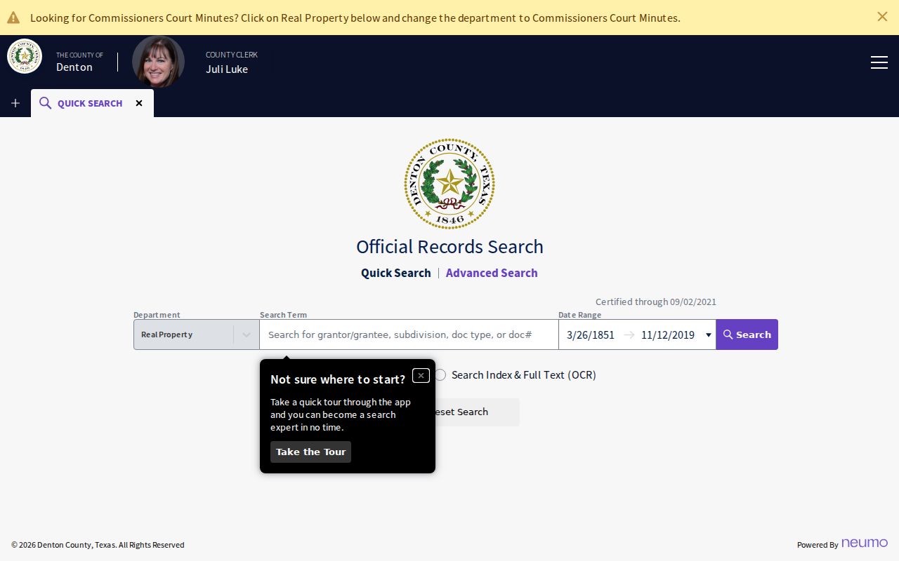
Search the grantee forward for a later conveyance and the grantor backward for the prior transfer. Compare lot, block, tract, survey, abstract, plat, release, assignment, and judgment references instead of forcing a metes-and-bounds description into a modern street number. The visible portal notice says records are certified through September 2, 2021, so retain that observed limitation with the search date. Images may require registration or payment.
Use Little Elm Plats for Streets
A plat is often the bridge between a current Little Elm street address and an older tract description. The town’s plat guidance describes lots, blocks, subdivisions, streets, utilities, parks or open space, drainage, flood protection, setbacks, and transaction use. When a deed changes from a tract description to a lot and block, the subdivision plat can explain the transition better than a broad name search.
Search the Little Elm archive advanced search for the street, plat, annexation, roadway, zoning, or Planning and Zoning terms, then inspect the relevant agenda or document. The archive exposes keyword, archive, board, and date-range controls. It can establish a public planning record or a date clue, but an applicant, speaker, or signatory in a meeting file is not thereby a resident.
Read Little Elm Annexation Dates
Street research can cross the incorporated town, its extraterritorial area, Denton County land with a Little Elm postal line, and addresses using another USPS city line. The 2021 Little Elm annexation map lists ordinance examples from 1969 through 2021 and also records dis-annexations. Compare the map, current GIS, deed dates, plats, and archive notices when a street has a different municipal history than its postal label suggests.
The map is a planning reference, not a legal survey. Its value in a Little Elm street directory workflow is as a date clue: it may explain why town and county records use different boundary or road context. No single public historical street-renumbering or complete street-alias table was found, so an unresolved older address should remain a documented gap rather than a guessed conversion.
Check Little Elm Building Permits
Building Safety records can tie a project address to an applicant, contractor, certificate, permit, or inspection reference. The Town of Little Elm says permits are reviewed, issued, and inspected for construction, alteration, repair, moving, demolition, occupancy changes, plumbing, and related development. The MyGov permits route is the operating channel, while the town’s permits page supplies the public starting point.
The Little Elm Building Permits and Safety page shows the permit, certificate, registration, and MyGov access path for address-based research.
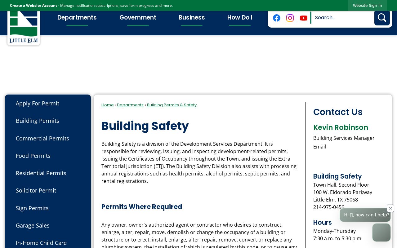
Public result fields, historical retention, and redaction rules were not published in a field-by-field guide. Ask the town office, use the authenticated MyGov route where appropriate, or make a defined Texas Public Information Act request for an existing record. A permit applicant or contractor may be an entity or representative, so that name should not be treated as a resident finding.
Trace Little Elm Street History
Historical street work relies on a dated collection, not an assumed continuous Little Elm reverse directory. The Denton Public Library genealogy guide documents telephone directories back to 1918 and Denton city directories from the 1930s. It also points to yearbooks, church histories, cemetery surveys, newspaper indexes, local histories, and the 1957 community history. The collection does not identify a continuous Little Elm criss-cross publisher or annual run.
Locate a street and house in the appropriate year, write down each household entry, then read the alphabetical half of the same volume for variant spellings, relationship notation, or telephone information. Compare the address with tax, deed, GIS, newspaper, census, or cemetery evidence. The historical collection work is covered in depth by the Little Elm city directories; here, the value is the address-order clue that supports a street trail.
Little Elm Street Record Gaps
A gap in a Denton County title chain may reflect record survival rather than an empty history. The 1875 courthouse fire destroyed most county records. TSLAC’s Denton County records guide lists deeds for 1854 to 1855 and 1875 to 1902, with direct and reverse indexes for 1875 to 1903 on reels 1302133, 1303134, and 1302135. It also records a missing Volume 61 and later unfilmed portions of Volumes 75 and 78.
When a Little Elm street trail stops in an early period, shift to the TSLAC reel notes, probate, tax rolls, newspapers, church registers, cemetery material, family histories, and county Research Room sources. Reservoir construction also relocated roads, structures, and cemeteries. An older place may need a locality name such as Lloyd, Hackberry, Dickson, Hilltown, rural route, or Denton County before it can be compared with a modern parcel map.
Note: The Library of Congress Sanborn map located for this research covers Denton in 1885, not Little Elm, so it cannot substitute for a Little Elm street map.
Limits of a Little Elm Street Directory
Address records do not make a complete public list of everyone on a street. The county tax and parcel systems identify property and mailing fields. A deed identifies recorded parties and a legal transaction. A voter result can concern registration status or precinct and may carry address restrictions. Utility account details are not a public resident list, and no official complete Little Elm roster of residents, voters, permit applicants, or license holders was located.
Texas confidentiality programs can protect voter addresses and other sensitive information. A failed search, a suppressed address, or an owner mailing field should never be used to infer a current residence. When the question changes from a street to confirming one person, use source-specific identity checks and the official custodian rather than drawing a conclusion from a single address record.